It was our forecasting team’s 1st active weather forecasting day, giving us the chance to forecast for the day and pick the chase target.
Issued for Wednesday at 8 AM EDT (1200 UTC)
Issued for Wednesday at 9:00 AM EDT (1300 UTC)
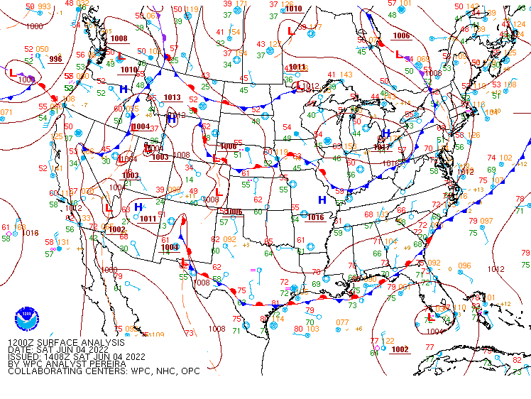
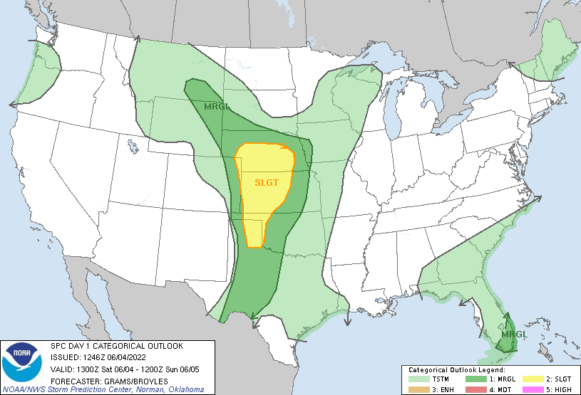
In preparing for our weather discussion, we noticed a stationary front located across southern Nebraska and a developing lee trough located in eastern Colorado. Both areas would be potential areas of lift for thunderstorms to develop. in the morning, dew points were increasing into the lower 60s across central Kansas and were expected to further increase throughout the day. There was also a mesoscale convective vortex (MCV) drifting over eastern Kansas, which cleared far enough east to not impede the potential for severe weather. My team looked over all the information and decided that we would target northwest Kansas near Goodland and eastern Colorado near the lee trough. We left our hotel in Amarillo and headed north, stopping for lunch at Macia’s in Sublette, Kansas. The food was great, but the lemonade was to die for. We continued moving north, stopping for gas in Oakley, Kansas, and looked over the developing setup. We saw some storms trying to develop in eastern Colorado so we decided to continue west into Colorado (and into another time zone!).
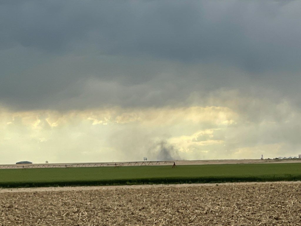
A few hours later we found ourselves near a Love’s travel stop in Burlington, Colorado in anticipation of the developing storms. These storms in eastern Colorado had a history of producing a gustnado or two, so we kept our eyes peeled. While we didn’t see a gustnado, we did see a microburst that was visible from the dust it was kicking up around it.
After several minutes of looking at the storm and radar, we noticed these thunderstorms beginning to wane out. So, to try and see something during the day, we decided to head northeast towards a cluster of thunderstorms over northwest Kansas. On our way, we were slowed down by a cell’s hail core which had produced quarter to half-dollar-sized hail. we pulled off I70 to wait for it to pass, then proceeded east. There were several outflow boundaries being produced from dissipating storms, which could produce enough low-level shear in our new target storm to produce a tornado.
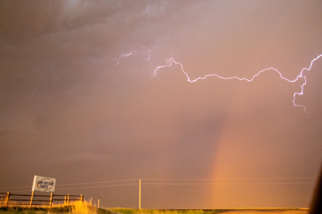
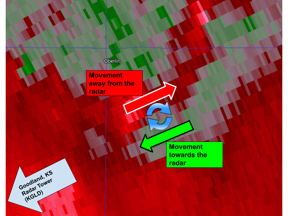
Continuing to target the cluster over northwest Kansas, which had remained almost stationary, we approached the town of Oberlin, Kansas to position ourselves to the southwest of the storm and get a clear view of the storm structure. We pulled off to a side road that was several miles to the South of the town and upon observation, we noticed two areas of rotation within the clouds: a cyclonic and anticyclonic rotation. This was interesting, as a thunderstorm will usually have rotation only in one direction. We also saw active lightning within this cluster, and a double rainbow from the sun beginning to set to the West. Fortunately, I was able to snap a picture of the double rainbow and some cloud-to-cloud lightning together before we needed to start moving south, as this cluster was beginning to slowly shift towards us.
We drove south on the road we came north on, and as I was driving I noticed something peculiar in the rearview mirror. I noticed a dust cloud towards the ground and a lowering in the clouds just above, both of which appeared to have some rotation. I casually said, “Dr. Decker, I think there’s a tornado behind us.” Everyone in the van looked towards the back and to their surprise, they saw the same thing. We found a spot on the side of the road to take a better look, and sure enough, it was a tornado! We stopped for a few minutes to get a better look, take some pictures, and admire nature at work. For me, this was the first tornado that I had ever seen so I was very excited, but I was also very cautious of my surroundings.

After the day had ended, we looked back at radar data, specifically velocity scans (which help tell where things are moving). To our surprise, we found that this tornado was associated with the anticyclonic rotation we previously saw, and a storm chaser to the north had also confirmed that this tornado was anticyclonic. This is rare because most tornadoes (in the Northern Hemisphere) rotate cyclonically mainly due to the rotation of the Earth.
Back to the chase day, several outflow boundaries from dissipating thunderstorms collided together to our West to produce a new cluster of thunderstorms that was beginning to move east towards us.
So with this cluster moving east, and the tornado-producing cluster to our northeast, we quickly drove south to get away from the intense storms. during our drive South, we were treated to some of the most active lightning that I had ever seen. It was one after another of bright cloud-to-ground lightning bolts and flickering anvil crawlers, producing an electric symphony of lightning.
We were able to avoid both of the clusters of thunderstorms that were on a collision course with each other, but we could still see lightning all around us. at this point, it was getting late and we had begun heading back to our hotel in Goodland KS. We eventually arrived at our hotel, which had another group of storm chasers checking in for the night. After an active day, we hit the beds and got ourselves some well-needed rest.

Leave a comment