We had another active day in store for us. For today, we have the possibility of several supercell thunderstorms now for Iowa, Missouri, Kansas, and Nebraska (the area of interest had shifted south compared to the previous days’ outlooks).
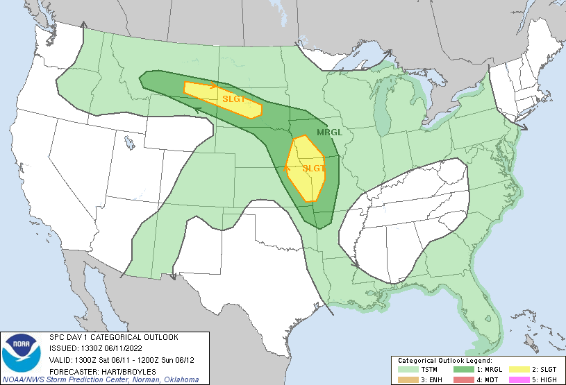
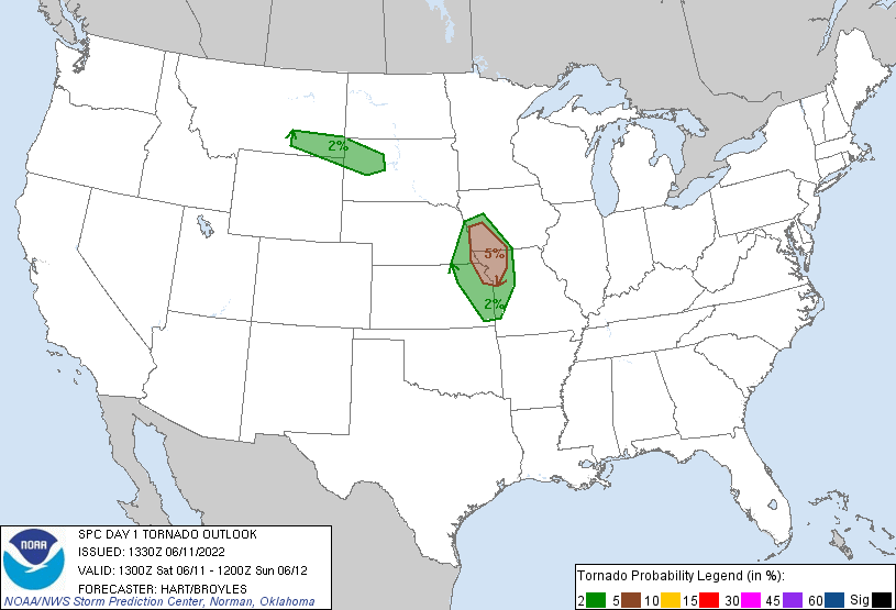
The SPC also tagged a 5% tornado risk for Southwestern Iowa, Northwestern Missouri, extreme Southeastern Nebraska, and Northeastern Kansas.
So, the forecasting team targeted Southwest Iowa as a staging area for the day. They picked Glenwood, IA, which had a good road network and a nearby bridge that would allow us to cross the Missouri River if severe weather looks more promising in Nebraska.
During our drive, we took several Kestrel readings with dew points in the lower to mid-70s. While it’s not pleasant to be in, it meant that there was ample moisture for thunderstorms to take advantage of for the day.
By the time we reached our targeted staging area, the stage was set for thunderstorms to develop, We waited to see what areas would begin firing up, and we didn’t have to wait too long to realize that we would have to cross into Nebraska.
We picked a cell that was isolated, which is good for chasing, that was over Maple Creek, Nebraska and tracking southeast. There was another supercell cluster forming to the south towards Lincoln, Nebraska, but that was out of range for us and it had become a rain-wrapped mess not good for safe storm chasing.
This cell we had followed had exhibited some decent rotation at all levels and seemed like it was going to produce a tornado. However, everytime this cell would have some clouds starting to lower and rotate, it would quickly rise back up into the cloud base. But this was an impressive storm structure to watch:
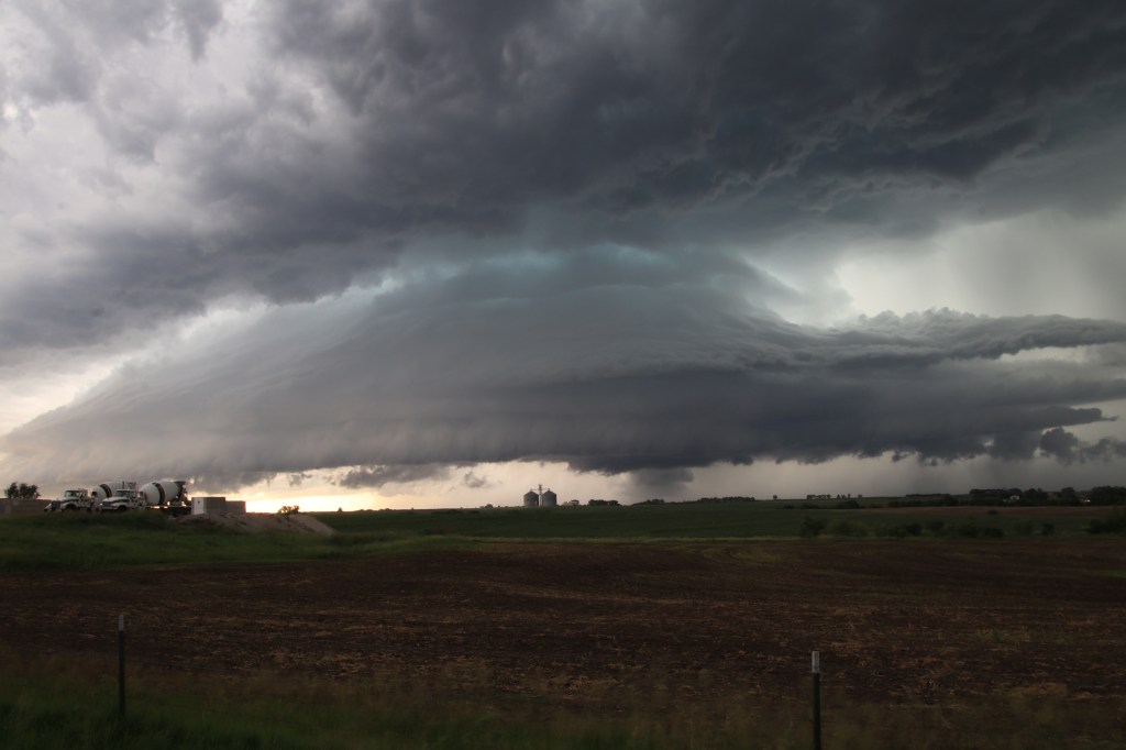
We knew we were on the right track, as there were several other storm chasers following this particular supercell. Even Reed Timmer, a famed storm chaser, was just a mile to our north following this supercell.
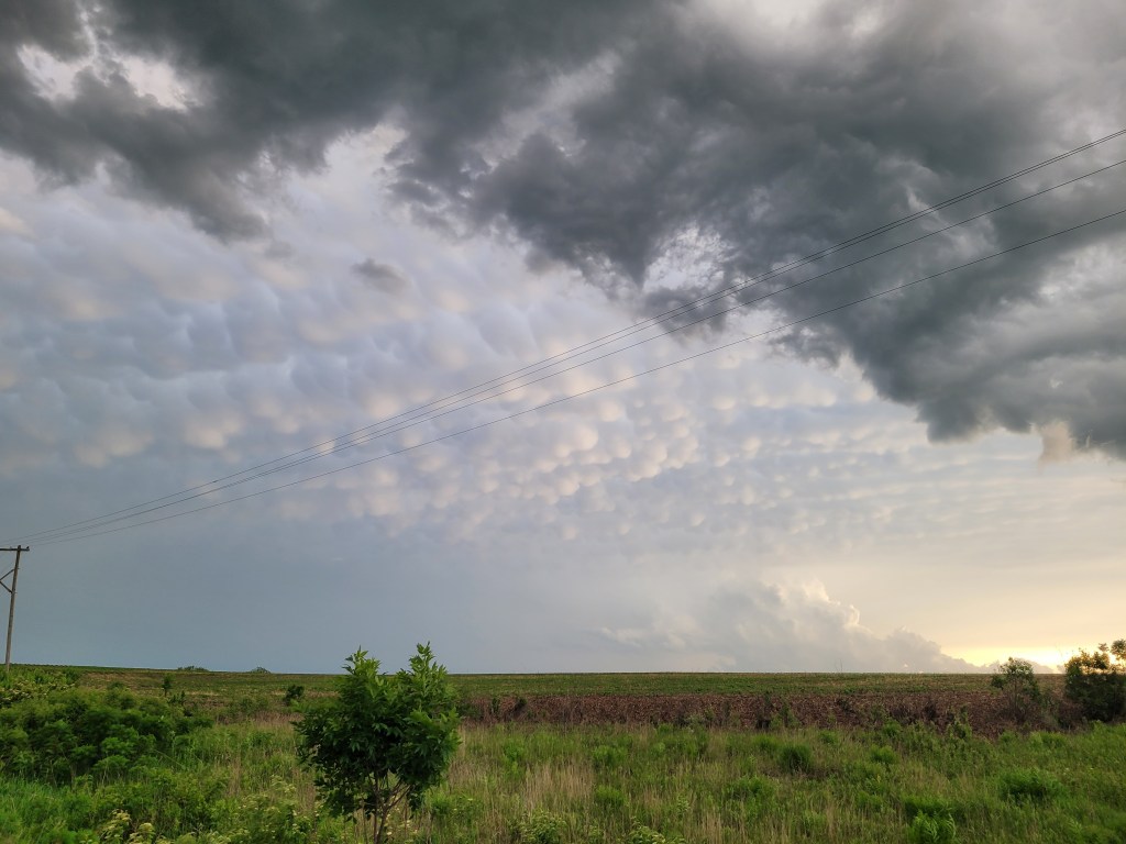
Things quickly began to degrade however as this supercell had begun to ingest rain-cooled outflow from the storm clusters to the south, leading to this storm to gust out and dissipate. On the bright side, we were treated to Mammatus clouds and gravity waves (possibly a mix/hybrid of the two).
With no other healthy storms nearby to chase, we had decided to call it a day and begin heading towards our hotel in Omaha, Nebraska. We first stopped for a nice Mexican-style dinner at the El Portal Mexican Restaurant. After a nice and filling meal, we headed for our hotel and wrapped up another active trip day.

Leave a comment