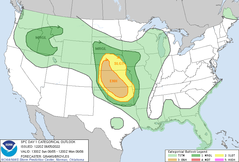
Waking up from a long chase day, we had another active day of weather ahead of us for the day ahead. The Storm Prediction Center had issued an ‘Enhanced’ risk (Level 3/5) for much of Kansas and parts of Central Nebraska. With this setup, the concern was mostly damaging winds from a progressive Mesoscale Convective System that was forecasted to develop during the day, but there was a possibility for tornadoes for the day as well.
We started the day by going north towards our first target area, McCook, Nebraska. During our drive north, we passed through the area where we spotted the anticyclonic tornado from the previous day (spoiler alert: we would pass through this area and Oberlin a few more times during the day). We had stopped for lunch at another hole-in-the-wall place called Ed’s Cafe in McCook and looked at all of the weather info we could. After some thought and looking at some developing thunderstorms to our south in Kansas, we decided to go back into Kansas to check this development out. However, as we arrived at the town of Hoxie, Kansas, we noticed that this development was not as healthy anymore. We pulled into a parking lot and continued to monitor conditions for a little bit. After more discussion, we decided to head back into Nebraska to target thunderstorms that were developing over Imperial, Nebraska, and beginning to head southeast. We ended passing again through Oberlin, Kansas, and McCook, Nebraska, and then proceeded west to get ahead and west of the storms firing up over Imperial, Nebraska.
It was our forecasting team’s 1st active weather forecasting day, giving us the chance to forecast for the day and pick the chase target.
Weather Prediction Center Surface Analysis Chart Issued for Wednesday at 8 AM EDT (1200 UTC)
Storm Prediction Center Day 1 Outlook Issued for Wednesday at 9:00 AM EDT (1300 UTC)
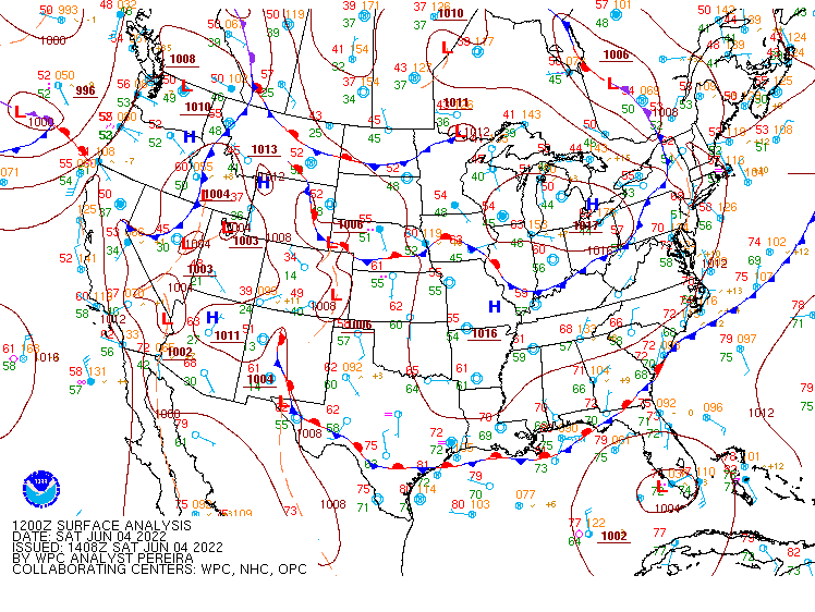
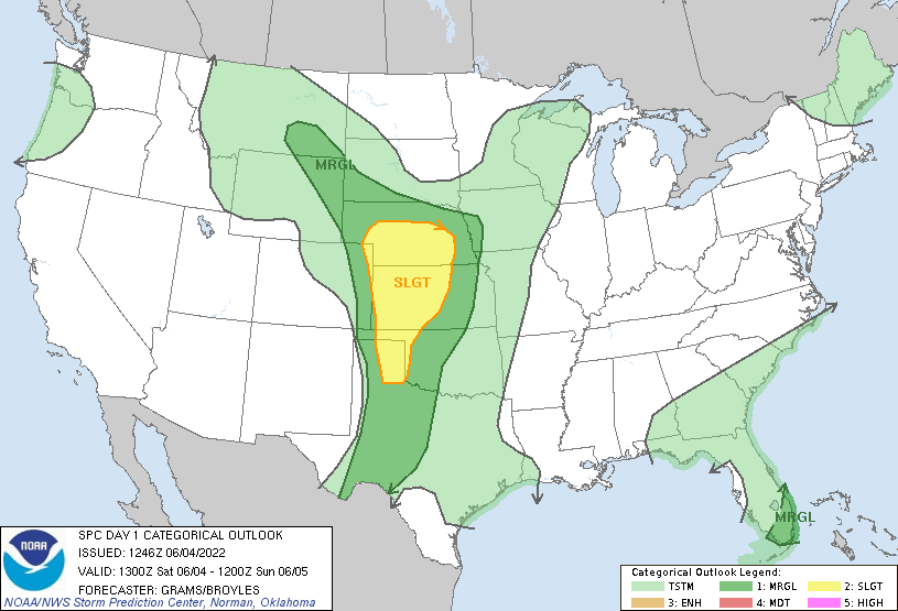
In preparing for our weather discussion, we noticed a stationary front located across southern Nebraska and a developing lee trough located in eastern Colorado. Both areas would be potential areas of lift for thunderstorms to develop. in the morning, dew points were increasing into the lower 60s across central Kansas and were expected to further increase throughout the day. There was also a mesoscale convective vortex (MCV) drifting over eastern Kansas, which cleared far enough east to not impede the potential for severe weather. My team looked over all the information and decided that we would target northwest Kansas near Goodland and eastern Colorado near the lee trough. We left our hotel in Amarillo and headed north, stopping for lunch at Macia’s in Sublette, Kansas. The food was great, but the lemonade was to die for. We continued moving north, stopping for gas in Oakley, Kansas, and looked over the developing setup. We saw some storms trying to develop in eastern Colorado so we decided to continue west into Colorado (and into another time zone!).
A few hours later we found ourselves near a Love’s travel stop in Burlington, Colorado in anticipation of the developing storms. These storms in eastern Colorado had a history of producing a gustnado or two, so we kept our eyes peeled. While we didn’t see a gustnado, we did see a microburst that was visible from the dust it was kicking up around it.
After several minutes of looking at the storm and radar, we noticed these thunderstorms beginning to wane out. So, to try and see something during the day, we decided to head northeast towards a cluster of thunderstorms over northwest Kansas. On our way, we were slowed down by a cell’s hail core which had produced quarter to half-dollar-sized hail. we pulled off I70 to wait for it to pass, then proceeded east. There were several outflow boundaries being produced from dissipating storms, which could produce enough low-level shear in our new target storm to produce a tornado.
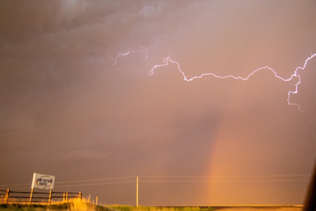
Continuing to target the cluster over northwest Kansas, which had remained almost stationary, we approached the town of Oberlin, Kansas to position ourselves to the southwest of the storm and get a clear view of the storm structure. We pulled off to a side road that was several miles to the South of the town and upon observation, we noticed two areas of rotation within the clouds: a cyclonic and anticyclonic rotation. This was interesting, as a thunderstorm will usually have rotation only in one direction. We also saw active lightning within this cluster, and a double rainbow from the sun beginning to set to the West. Fortunately, I was able to snap a picture of the double rainbow and some cloud-to-cloud lightning together before we needed to start moving south, as this cluster was beginning to slowly shift towards us.
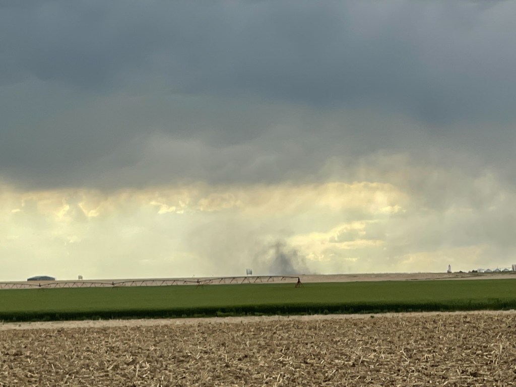
We drove south on the road we came north on, and as I was driving I noticed something peculiar in the rearview mirror. I noticed a dust cloud towards the ground and a lowering in the clouds just above, both of which appeared to have some rotation. I casually said, “Dr. Decker, I think there’s a tornado behind us.” Everyone in the van looked towards the back and to their surprise, they saw the same thing. We found a spot on the side of the road to take a better look, and sure enough, it was a tornado! We stopped for a few minutes to get a better look, take some pictures, and admire nature at work. For me, this was the first tornado that I had ever seen so I was very excited, but I was also very cautious of my surroundings.
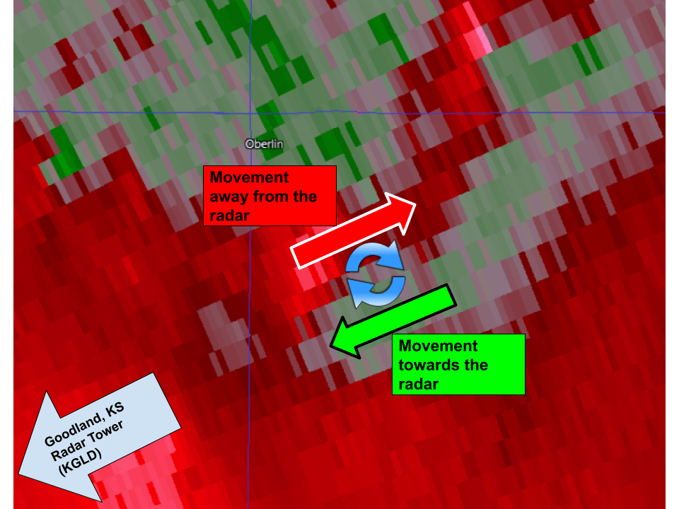
After the day had ended, we looked back at radar data, specifically velocity scans (which help tell where things are moving). To our surprise, we found that this tornado was associated with the anticyclonic rotation we previously saw, and a storm chaser to the north had also confirmed that this tornado was anticyclonic. This is rare because most tornadoes (in the Northern Hemisphere) rotate cyclonically mainly due to the rotation of the Earth.
Back to the chase day, several outflow boundaries from dissipating thunderstorms collided together to our West to produce a new cluster of thunderstorms that was beginning to move east towards us.
New thunderstorm activity getting started up by outflow boundaries from previous and ongoing thunderstorms. You can see these outflow boundaries faintly on radar.
So with this cluster moving east, and the tornado-producing cluster to our northeast, we quickly drove south to get away from the intense storms. during our drive South, we were treated to some of the most active lightning that I had ever seen. It was one after another of bright cloud-to-ground lightning bolts and flickering anvil crawlers, producing an electric symphony of lightning.
We were able to avoid both of the clusters of thunderstorms that were on a collision course with each other, but we could still see lightning all around us. at this point, it was getting late and we had begun heading back to our hotel in Goodland KS. We eventually arrived at our hotel, which had another group of storm chasers checking in for the night. After an active day, we hit the beds and got ourselves some well-needed rest.
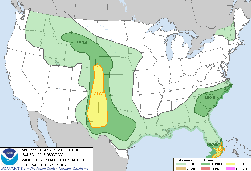
It was go time! We awoke on our first chase day and model guidance had bumped up the amount of wind shear present with the severe weather setup we were targeting over the Texas Panhandle and Eastern New Mexico, increasing the probability of rotating thunderstorms and a tornado or two. Also, the Storm Prediction Center has increased the severe weather risk for our target area to a Slight risk with a new 2% tornado risk for the day.
Storm Prediction Center Day 1 Outlook Issued for Wednesday at 8 AM EDT (1300 UTC)
Storm Prediction Center Day 1 Tornado Probability Issued for Wednesday at 8 AM EDT (1300 UTC)
The forecasting team of the day looked over the information and we held our morning discussion to discuss it all. The breakdown was that there would be a swath of moisture present, as well as instability and some modest wind shear in the Southern High Plains. The instability would help any thunderstorms grow and mature, and a present upper-level disturbance (a shortwave trough) would give the starting nudge needed for these thunderstorms to develop.
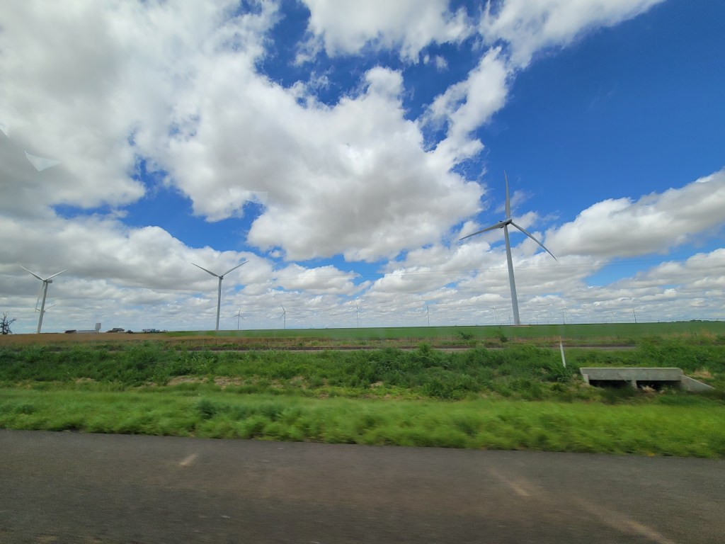
So the team decided to proceed with traveling to Eastern New Mexico and the Western Texas Panhandle. So with our target set, we trekked west. On our way, we passed the expansive wind farms of the Texas Panhandle. I always knew this and that many other areas in the Central US had large wind farms, but seeing it in person gave me a perspective of just how large and expansive they really were.
We stopped at Hasty’s Restaurant in Shamrock, Texas (about 90 miles east of Amarillo) to get some lunch and look at the weather conditions. Looking over the data and eating a decent meal, we noticed that there was an area over Eastern New Mexico that was looking promising. There were storms developing over the high terrain where CAPE (convective available potential energy) and wind shear were favorable for the further development of these storms into organized/rotating storms. So with our target showing promise, we continued trekking west.
We quickly stopped in Tucumcari for fuel, and then proceeded south to get ahead of a developed thunderstorm that was showing some weak signs of rotation.
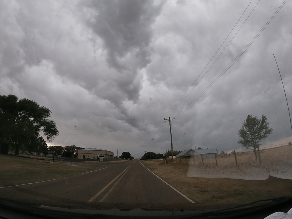
On our way south, we passed through House, New Mexico, a community that look all but inhabited. It looked more akin to a ghost town and really set an eerie feel.
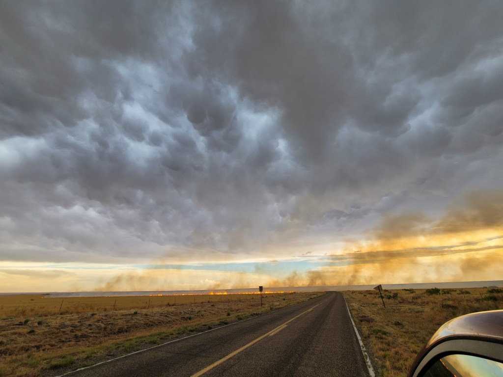
Continuing south, we passed through the town of Fort Sumner and attempted to proceed further south on a road that led to Roswell, NM. I say attempted because we were quickly stopped by a brush fire that had grown to engulf the road ahead of us. It was likely started from the intense cloud-to-ground lightning with this thunderstorm and was being fanned by the inflow of the thunderstorm (which could be made visible because of the smoke from the fire).
Considering that we had rental vans, we didn’t want to risk driving through and damaging them and we didn’t want to stick around for the hail core of the thunderstorm. So after sticking on the side of the road to look at the storm structure, we then proceeded back north. There was a possible thunderstorm that we could have gone after, but it was quickly diminishing during our drive towards House, NM.
Since it was starting to get late and the sun was getting close to setting, we called it for the day and started heading to our hotel for the night in Amarillo, Texas. During our drive, we started to receive a clear signal on our van’s radio from a radio station in the Upper Michigan Penninsula, which was about 1,100 miles away. This was possibly due to the conditions of the atmosphere between the two locations allowing for the signal to continue further than targeted. It was an odd experience and coupled with the creepy ghost town, it felt like an episode of ‘The Twilight Zone’.
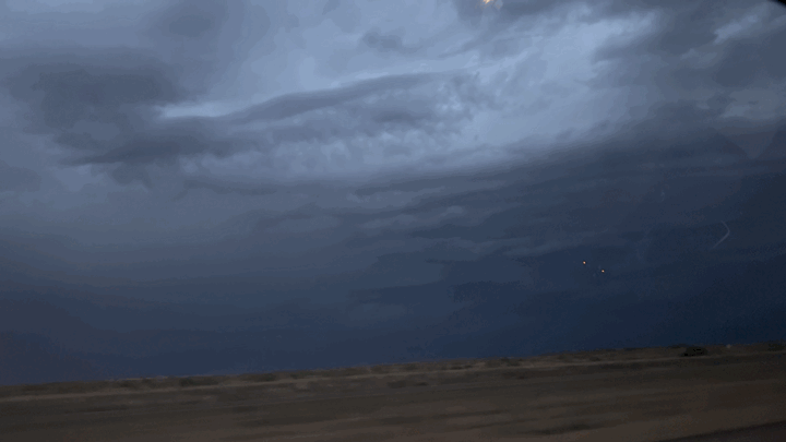
On our way out of New Mexico, we saw some impressive lightning from the few thunderstorms that were still going at this point. I’ll admit, it was hard for me while driving not to look out the window here and there to admire the beautiful lightning show.
We eventually arrived at the Sleep Inn in Amarillo, Texas, and after a long first chase day, we all headed to bed in anticipation of what the rest of the trip had in store.
Well, today was a relatively quiet day out in the Midwest (other than some quick morning rain showers). It was mostly a day to drive to get to our intended destination of the Texas Panhandle for anticipated severe weather on Friday, which so far looks to be interesting (more on that in a second).
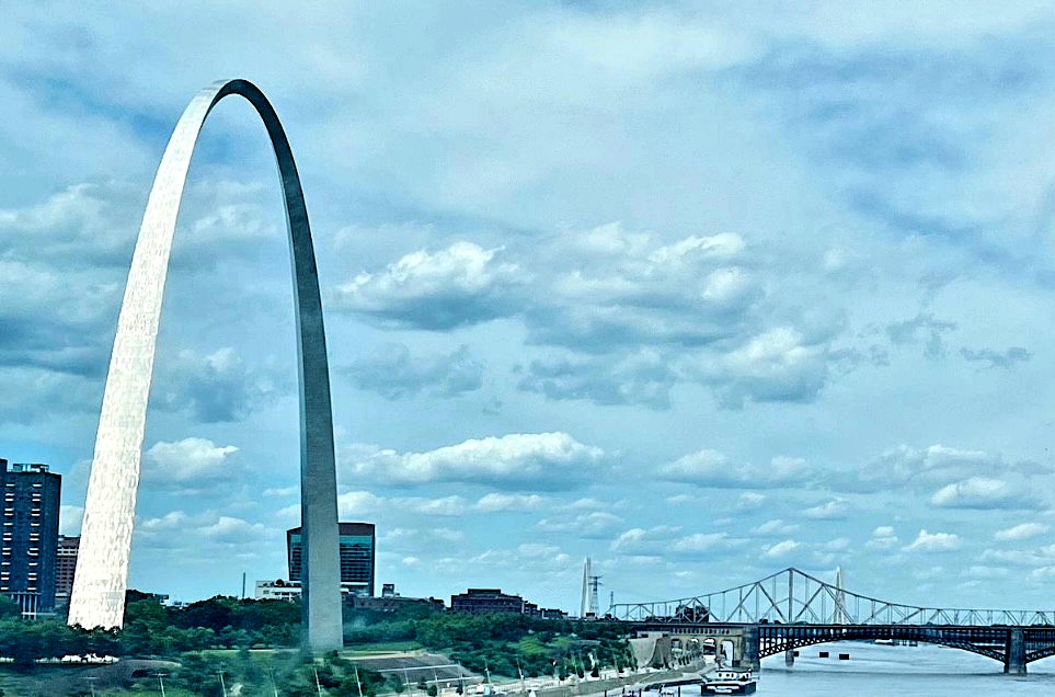
We drove from our hotel in Richmond, Indiana (thank you Best Western!) to Illinois where we stop at the visitor center on I-70 to stretch out and take a break. From there, we drove through Missouri and got to see the Gateway Arch from a good viewing distance. Seeing the Gateway Arch for the first time in person was awesome, even if it was in passing! It was much larger than I had expected it to be.
Picture of Gateway Arch from where we were on the highway Courtesy of Meghan Anderson (thank you Meghan for taking this for me while I was driving!)
For the majority of our drive through Missouri, the class participated in an van-vs-van trivia game with Dr. Decker reading the trivia questions over walkie talkie. Unfortunately, Scarlet was beaten by Goose this time around, but there’s hope for a trivia victory for Scarlet. We then proceeded to play games within our vans to pass the time. After several hours of driving, we ended up stopping at an Olive Garden in Joplin, Missouri for a nice sit down dinner together. We then proceeded to our final stop of the day: our hotel for the night in Claremore, Oklahoma. As we approached the border of Missouri and Oklahoma, we couldn’t resist blasting Oklahoma from the musical Oklahoma! as we passed into Oklahoma.
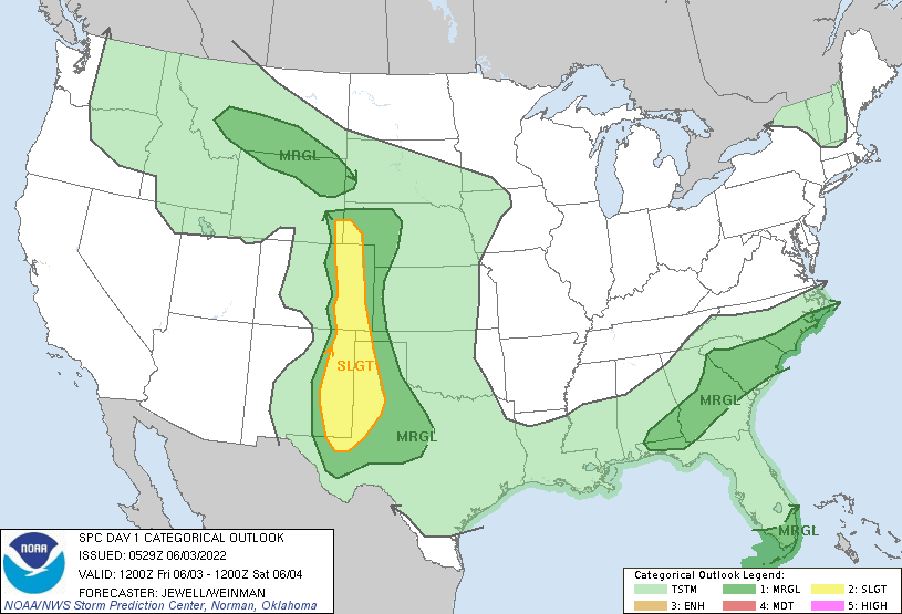
So now today’s recap is done, let’s talk weather; the reason for this whole trip! We’re aiming to chase some thunderstorms that will likely form in Eastern New Mexico and the Texas Panhandle. The main threats for these thunderstorms will be damaging wind gusts and severe hail (tornadoes are not likely due to the lack of wind shear likely to be present during this time, but it’s not impossible).
Storm Prediction Center Day 1 Outlook Issued for Friday, June 3rd (As of 6Z Fri [1AM EDT])
There is the possibility of discrete, or separated thunderstorms to start over Eastern New Mexico and the Texas Panhandle. With this and the open space of the area, viewing these thunderstorms will be very easy and we can track from a far. For that reason, we will be heading for this area tomorrow first thing in the morning so we can get there before or as thunderstorms begin to initiate.
Today was the first day of our long trek west. After meeting on the Cook Campus at 6 AM to load up Scarlet and Goose (our two minivans for the trip) and discuss a destination, we departed our familiar surroundings. Before going far, we stopped at a Cracker Barrel in PA to load up with the most important meal of the day. From there, we travelled west. After almost 600 miles and about 12 hours of traveling, we’ve made it to Richmond, Indiana!
Weather Prediction Center Day 1 National Forecast Chart Issued for Wednesday
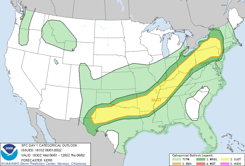
Storm Prediction Center Day 1 Outlook Issued for Wednesday at 12:30 PM EDT (1630 UTC)
But today was not all travel, as we were greeted with a cold front across the Ohio Valley that produced some isolated thunderstorms capable of small hail and damaging wind gusts. These thunderstorms were not favorable for tornadoes because of a lack of shear present in the atmosphere, which is changing wind speed and direction with height. Nevertheless, they were something to watch out for.
Since the route to Texas, our intended destination ran through this area, we were able to get a little warm-up (or as Dr. Decker called it, an “appetizer”) before we hopefully get to see what the Great Plains has to offer. We weaved our way through central Ohio and around Columbus as we made our way west and got to see some of these isolated thunderstorms. We were not able to witness any hail or strong winds, but we were able to partially see the full structure of everything and see the atmosphere at work.
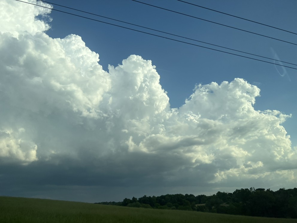
Towering Cumulus Clouds over Granville, OHAn outflow boundary produced by surrounding thunderstorms near London, OH
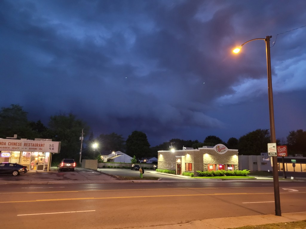
While we hope to see some more action on Friday near the Texas Panhandle, today was a nice warm-up for this trip. Plus, we were greeted with some frequent lightning as we stopped for dinner. A fellow classmate and I almost got soaked as a line of thunderstorms started making their way through where we were. We even got to see a wall cloud illuminated by the frequent lightning and the little remaining light there was after sunset (see below).
Wall Cloud over Springfield, OH
Even though today was a long day, it was an enjoyable one and I cannot wait for what the rest of the trip has in store! Hopefully, I’ll have some more weather to share (more pictures and videos for sure)!
Hello everyone! I would like to welcome you all to my blog centered on my Severe Weather Forecasting Field Trip that I will be going on for the next two weeks! I will be storm chasing with some of my fellow Rutgers meteorology students and with one of my meteorology professors, Dr. Stephen Decker. During this trip, I will be able to apply all that I have learned in the classroom out in a real-world setting. I will also be learning more about the weather, specifically severe weather. Also, for the duration of the trip, you get to tag along with me as I write and share my experiences about forecasting, observing, and analyzing severe weather in one of the most active areas for severe weather: Tornado Alley. They’ll be lots of pictures and videos, so look out for some awesome shots of both severe weather and of stops we make along the way in search of said severe weather. There will also be some deep dives into the processes and concepts that go into forecasting and analyzing severe weather.
But first, here’s a quick recap what happened today! Today our class met for an orientation to discuss the guidelines of the trip and what to expect during it. Thankfully, the room we met in was not as hot and humid as it was outside at the time. We then settled van arrangements and forecast teams for the duration of the trip. The class is divided into 3 forecast teams, each getting a chance during the trip to forecast the weather and where to go for a day. I’m a part of the first team, and thus, get to forecast the weather for the first day of the trip and where we ultimately decide to go first.
We begin our trek west on Wednesday, June 1st at 6:00AM (or 10Z for those that are familiar with UTC time). I won’t give too much away yet, but we’re eying up some potential severe weather for the Ohio Valley for Wednesday and also for the Texas Panhandle on Thursday. Which way we decide to go has not been fully decided yet, but I have a feeling we’ll be able to see some severe weather in passing before heading out to the Great Plains.
Wish us luck for a safe journey (and for some prime severe weather), and I hope you enjoy this blog!