The day ahead looked to be a day with less travel, as we were mainly within the target area for severe weather for the day.

The Storm Prediction Center had issued an ‘Enhanced’ risk (Level 3/5) for Central/South Nebraska and North Kansas (our second ‘Enhanced’ risk chase day and back-to-back). But something else was brewing as well, and that was dirty laundry. Fortunately, a laundromat was a few minutes away from our hotel. Our forecasting team was up for the day, and we had decided to first do some laundry, as we only packed a week’s worth of clothes so we could pack lightly. That also gave us more time to wait for the next SPC Outlook for the day and for more information to come our way to make a chase decision.
The day’s setup was this: a shortwave trough was moving southeast away from the Northern Rockies and into Nebraska/Kansas. This area was forecasted to have mixed-layer CAPE (energy available in all levels of the atmosphere) around 1000-2000 J/kg, which is enough energy for severe thunderstorms. The main concern with these thunderstorms would be damaging wind gusts (courtesy of a swatch of 50-70 kt winds present at 500-mb for tall thunderstorms to tap into and bring down to the surface), but there was also a concern for large hail and possibly a tornado or two.
After finishing laundry and discussing with my team, we had decided to shift a little south and west towards Grant, Nebraska, to wait and see what materializes. Before reaching Grant, we stopped for lunch at a Runza, a “Nebraska delicacy.” We then continued our drive, arrived at a park in Grant, and waited. After waiting a few hours and watching the thunderstorms beginning to develop, we saw two supercells starting to take shape over Sidney and Chappell, Nebraska. These cells were tracking southeast towards our north, so we left the park to inch a little to the north for a more favorable view. Here, we saw several dust devils form:
We also saw a lowering beginning to develop with the cell closer to us.
We noticed that these cells were inching closer and closer, so we moved to reposition ourselves to the south of the anticipated track of these cells. However, these cells quickly intensified and began to turn right (south), putting us in the path of the heaviest precipitation and the hail core. These cells also began to pick up speed and become intertwined.
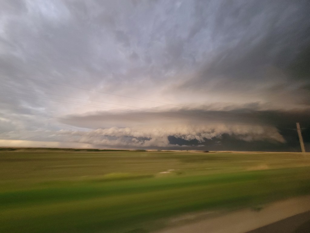
It quickly changed from storm chasing to storm running to outrun a severe cluster of supercells that reportedly dropped tennis ball to baseball-sized hail. We were only able to pull off twice for two minutes at most. The first time we stopped, I had measured sustained winds of up to 30 mph from the inflow of these clusters. Then we had to quickly continue south away from these clusters, which had begun exhibiting up to four areas of rotation at once.
We again (but quickly) drove through McCook, Nebraska, and Oberlin, Kansas to get away from this racing cluster of thunderstorms.
The sun was setting by the time we were out of Oberlin, so we had decided to continue driving south and make our dinner stop at an IHOP in Oakley and let this monster cluster move past our hotel before checking in (which was in Hays, Kansas). After some delicious breakfast for dinner, we drove east towards our hotel for the evening in Hays, Kansas. I remember getting into my hotel room and quickly falling asleep; it was definitely a long day!

Leave a comment