Hi there! This is a blog that I completed as part of my Severe Weather Forecasting Field Trip. The field trip took us across many parts of the US in search of severe weather at its fullest.
Day 0: Welcome!
Hello everyone! I would like to welcome you all to my blog centered on my Severe Weather Forecasting Field Trip that I will be going on for the next two weeks! I will be storm chasing with some of my fellow Rutgers meteorology students and with one of my meteorology professors, Dr. Stephen Decker.…
Keep readingDay 1: The Trek Begins
Today was the first day of our long trek west. After meeting on the Cook Campus at 6 AM to load up Scarlet and Goose (our two minivans for the trip) and discuss a destination, we departed our familiar surroundings. Before going far, we stopped at a Cracker Barrel in PA to load up…
Keep readingDay 2: OKLAHOMA!
Well, today was a relatively quiet day out in the Midwest (other than some quick morning rain showers). It was mostly a day to drive to get to our intended destination of the Texas Panhandle for anticipated severe weather on Friday, which so far looks to be interesting (more on that in a second).…
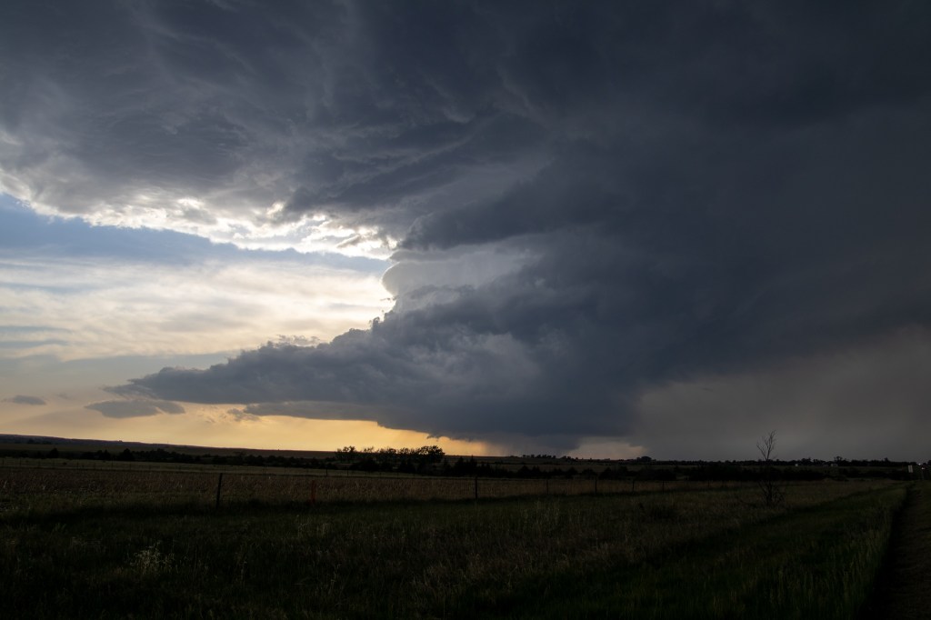
Keep readingDay 3: Brush Fires & Ghost Towns (1st Chase Day!)
It was go time! We awoke on our first chase day and model guidance had bumped up the amount of wind shear present with the severe weather setup we were targeting over the Texas Panhandle and Eastern New Mexico, increasing the probability of rotating thunderstorms and a tornado or two. Also, the Storm Prediction…
Keep readingDay 4: A Rare Tornado & A Symphony of Lightning
It was our forecasting team’s 1st active weather forecasting day, giving us the chance to forecast for the day and pick the chase target. In preparing for our weather discussion, we noticed a stationary front located across southern Nebraska and a developing lee trough located in eastern Colorado. Both areas would be potential areas…
Keep readingDay 5: “There and Back Again” (Twice!)
Waking up from a long chase day, we had another active day of weather ahead of us for the day ahead. The Storm Prediction Center had issued an ‘Enhanced’ risk (Level 3/5) for much of Kansas and parts of Central Nebraska. With this setup, the concern was mostly damaging winds from a progressive Mesoscale…
Keep readingDay 6: Chasing In The Sand Hills
The day’s severe weather setup was courtesy of a low-amplitude shortwave trough forecasted to move east. Model guidance had consistently predicted long-tracking supercell thunderstorms, with one originating near the Black Hills and tracking diagonally through all of Nebraska. This was something interesting to watch for, and the forecasting team for the day decided to…
Keep readingDay 7: The Chasers Become The Chased
The day ahead looked to be a day with less travel, as we were mainly within the target area for severe weather for the day. The Storm Prediction Center had issued an ‘Enhanced’ risk (Level 3/5) for Central/South Nebraska and North Kansas (our second ‘Enhanced’ risk chase day and back-to-back). But something else was…
Keep readingDay 8: “Goose” Lays a Goose Egg, Seeing An Old Friend, & Escape Room!
Today was a much-needed maintenance day for our vans, as Scarlett was in need of an oil change and Goose had some other maintenance issues that needed to be fixed. Since everything was far and wide in Kansas add our rental vans could only be taken to approved shops, we needed to travel to…
Keep readingDay 9: Back to Chasing & Two More Tornadoes?
After a long and fun rest day, it was back to storm chasing. Two targets were setting up for the day: #1) North/Central Nebraska toward Valentine #2) Southwest Nebraska towards North Platte This depended on changing conditions, so we headed for Nebraska with some time to think about which target to go for (since…
Keep readingDay 10: Badlands & Prairie Dogs
For the first time in a little more than a week, we were not within an area forecasted for active severe weather. The main focus was towards the ArkLaMiss area (Arkansas, Louisianna, & Mississippi) as a large and persistent MCS developed from the previous day’s severe weather was heading southeast towards that area and…
Keep readingDay 11: Chasing Along the Missouri River
We had another active day in store for us. For today, we have the possibility of several supercell thunderstorms now for Iowa, Missouri, Kansas, and Nebraska (the area of interest had shifted south compared to the previous days’ outlooks). The SPC also tagged a 5% tornado risk for Southwestern Iowa, Northwestern Missouri, extreme Southeastern…
Keep readingDay 12: A Bust Day
So today was a challenging forecast/decision day. There were two areas of severe weather expected for the day: #1) An uncertain setup stretching from Eastern Missouri to Southwestern Indiana. #2) A more promising setup toward Western Nebraska and South Dakota If we were to go after the more promising area in the Northern Plains,…
Keep readingDay 13: DERECHO!
Today was our last forecast day for our team and for the entire trip before we needed to head back home. So here’s the breakdown: some isolated thunderstorms were possible along a warm front for Central Illinois and Indiana before getting dominated by an MCS (possibly a derecho based on what models had indicated)…
Keep readingDay 14: “Homeward Bound”
Well, after getting some sleep after a late arrival, it was time to start taking the same road we came west on and head for home. We had 9-10 hours worth of driving ahead of us, so we got started as early as we could (without cutting down on too much sleep of course).…
Keep readingGet new content delivered directly to your inbox.
