Category: Severe Weather Forecasting Field Trip

  • Day E: Epilogue & Presentation

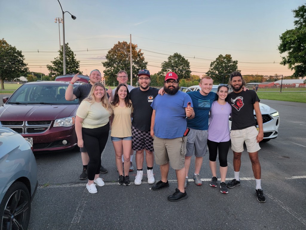
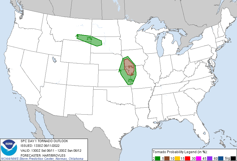
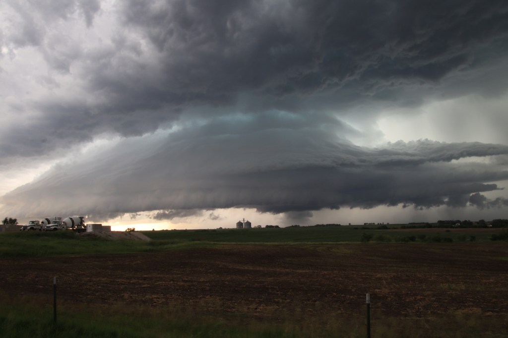
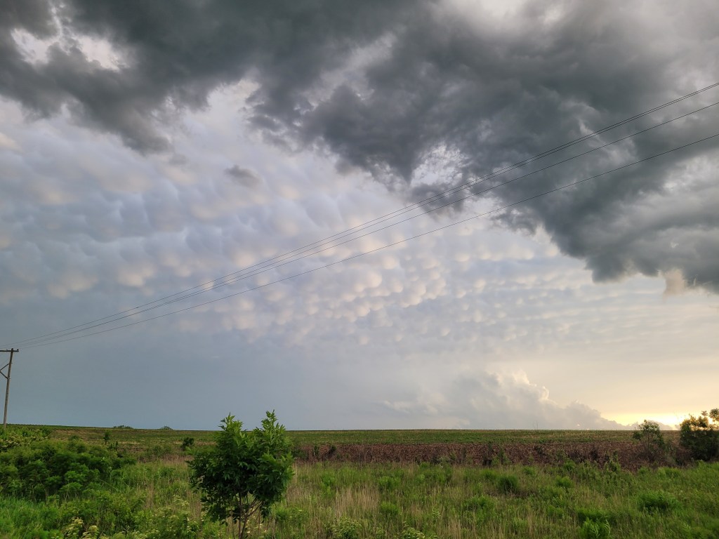
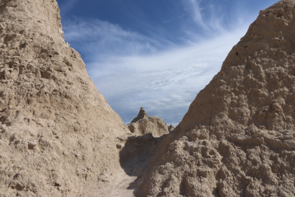
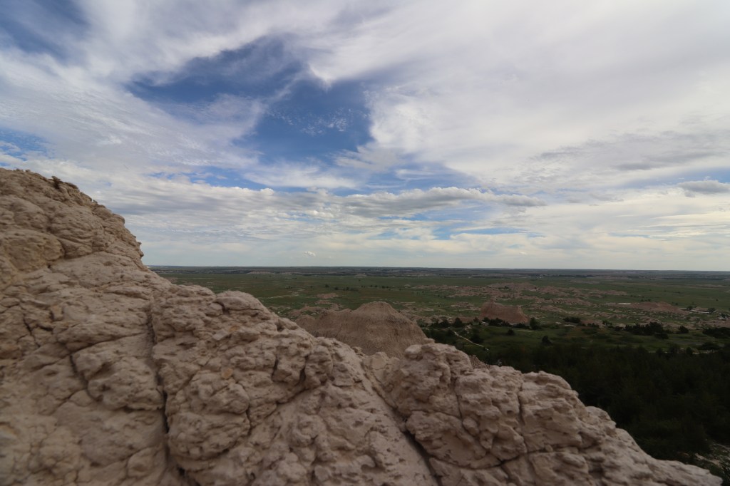
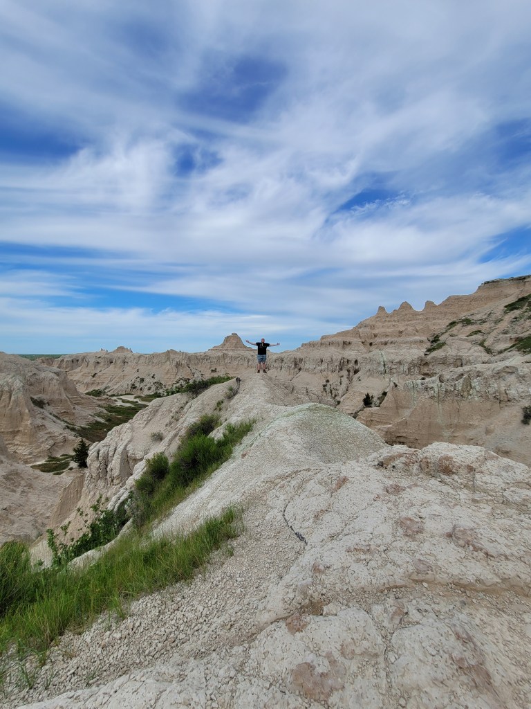
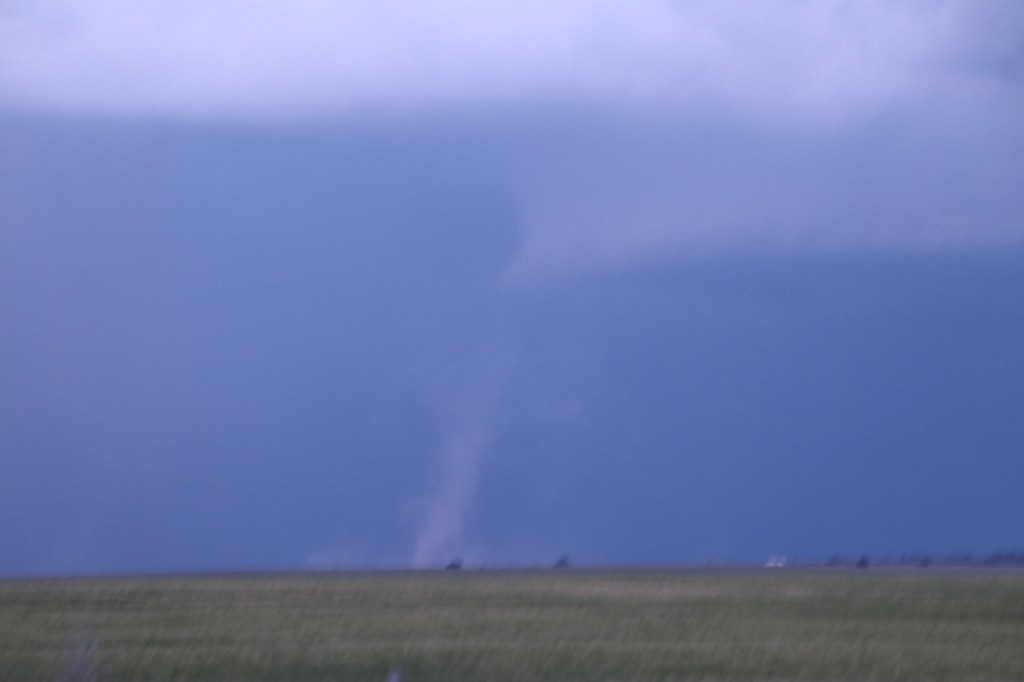
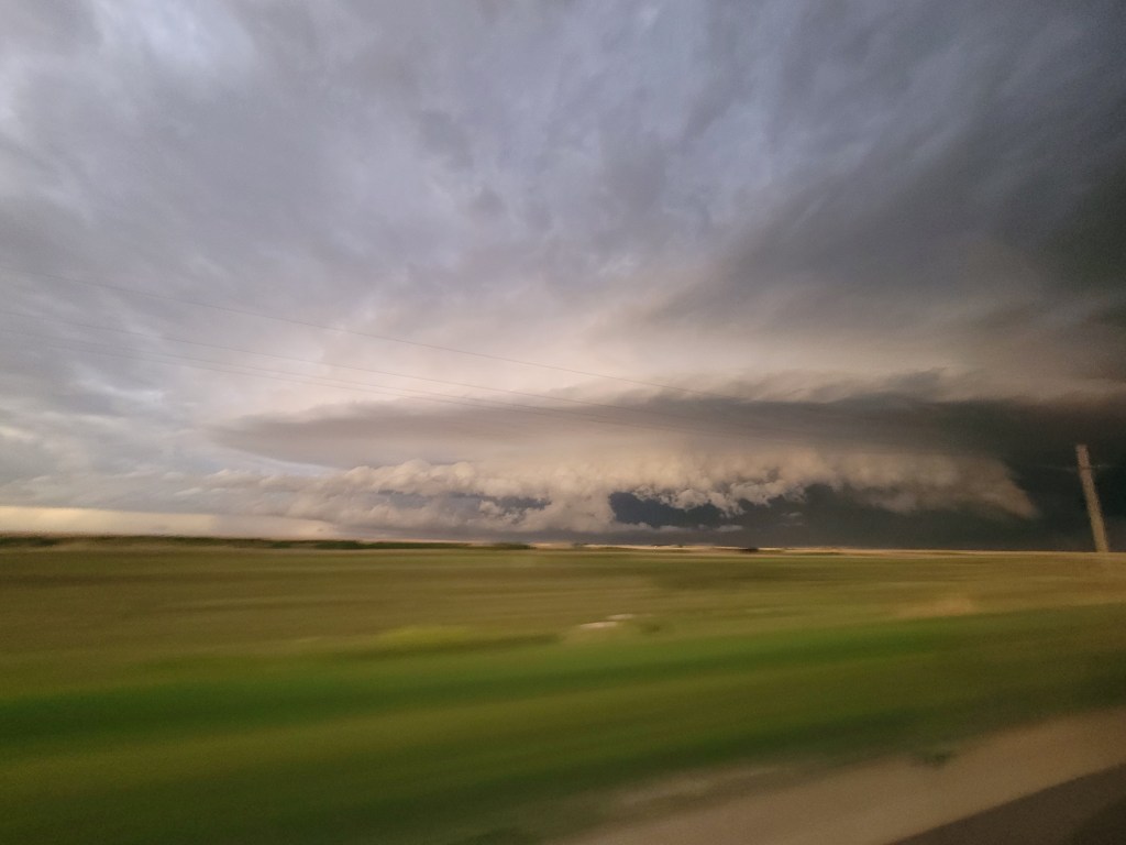
    One final day for this class: presentation day! Our forecasting team decided to present on our team’s first forecast day, during which we saw the rare anticyclonic tornado in Oberlin, Kansas. The other forecasting teams also each selected a day to present on, while Dr. Decker gave an overview of the rest of the trip.

    Before getting into our trip, Dr. Decker shared some interesting statistics and firsts on the trip:

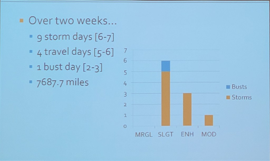
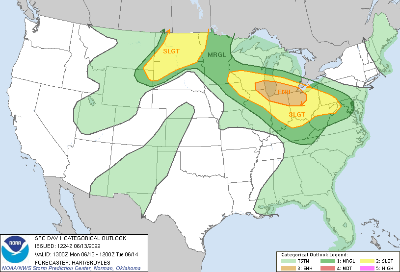
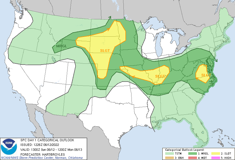
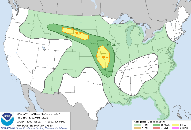
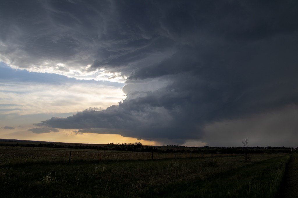
    During our trip, we had 9 active storm days, which was above the trip historical average of 6-7 active storm days, highlighting the heightened activity during the trip. We also had 4 travel days (days just meant for traveling), which was below the trip historical average of 5-6 travel days, and only 1 bust day (a day where severe weather did not materialize as planned).

    In addition to our above-average storm days and below-average travel days, our trip was one for the history books:

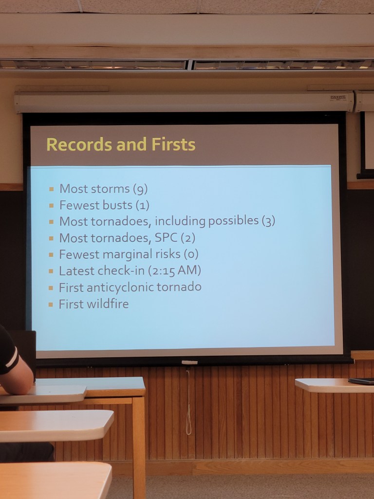
    Our trip had the most storm days and the fewest busts in the history of this trip being offered at Rutgers. We also saw the most tornadoes, including possible tornadoes and SPC confirmed tornadoes. One of these tornadoes was the rare anticyclonic tornado in Oberlin, Kansas, making for the first anticyclonic tornado ever seen in trip history. We also had the fewest ‘Marginal’ risk (Level 1/5) chase days, the first wildfire, and the latest hotel check-in time in trip history.

    After an overview of the trip and a look at records, our forecasting team was the first to give their presentation (which you can view right below!)

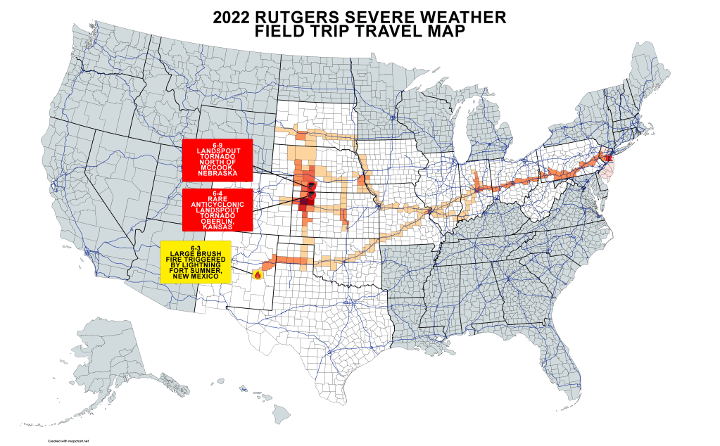
    Also, while this was not featured during the presentation day, I created a map showing where we traveled, as well as where we saw our two confirmed tornadoes and one wildfire:

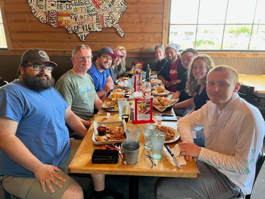
    After all of our presentations and the main overview of the trip was over, we had officially wrapped up the course. We all parted ways and took with us awesome memories of this trip.

    On a separate note, this was my last meteorology course at Rutgers University. While writing this post, I reflect on my experiences at Rutgers. From late nights in the ENR (Environmental & Natural Resources) building studying and completing assignments to early mornings going to the weather station to collect the weather observation for the day and also going into the WeatherWatcher studio in Perry Hall to record a campus weather forecast it has been one heck of a journey to get to this point. While I’m taking one final, non-meteorology class during the summer, there are many more classes and semesters behind me than there are ahead. It has been an extraordinary learning experience, not just in the classroom but also in my extracurricular and life experiences at Rutgers. I cannot thank the people there enough for it, especially my professors!

  • Day 14: “Homeward Bound”

    Well, after getting some sleep after a late arrival, it was time to start taking the same road we came west on and head for home. We had 9-10 hours worth of driving ahead of us, so we got started as early as we could (without cutting down on too much sleep of course). Driving through Pennsylvania a second time, I can say that driving through this state felt infinite. But after what seemed like forever, we were seeing familiar sights: the Garden State!

    We arrived at the ENR (the Environmental & Natural Resources building) around 8:30 PM to a welcoming committee consisting of our parents and friends waiting to see us after a long two weeks.

    We ended the trip with a total of 7687.7 miles being driven. We had also driven through 15 states during the trip, most of which I’d never been in before going on the trip. While this was an awesome trip and I got to see a lot of awesome things, it was nice to finally see home again…

  • Day 13: DERECHO!

    Today was our last forecast day for our team and for the entire trip before we needed to head back home.

    So here’s the breakdown: some isolated thunderstorms were possible along a warm front for Central Illinois and Indiana before getting dominated by an MCS (possibly a derecho based on what models had indicated) expected to develop and track across the area.

    We targeted Greenfield, Indiana, which would allow us to view these isolated thunderstorms if they did occur, and also provide us with a good road network to head north if nothing forms along the warm front. We departed, and during our drive, we once again had Kestrel reading with dew points in the mid-70s.

    There were some isolated cells beginning to fire up over Central Indiana, but it quickly became a multicellular cluster of thunderstorms and showers, making it difficult to see any features. So as a last effort to try and catch something with discernable features (and maybe a tornado), we headed northwest towards Northwestern Indiana to view a cell over Southeast Wisconsin that was showing healthy development and was beginning to separate for the developing MCS.

    After some driving, we stopped for some dinner at Wings Etc. in Rochester, Indiana to load up on chaser fuel and to monitor the situation. Within about 15 minutes, the cell we were watching had a Mesoscale Discussion put on it, then a Severe Thunderstorm Watch, then a Tornado Watch, and began to exhibit strong signs of rotation as it passed close by to Chicago. So after we wrapped up our dinner, we quickly headed for an open area to see the cell from afar. We were able to see the anvil structure of this cell from dozens of miles away. It wasn’t until an hour or two of waiting before we could begin to make out the bottom of the cell, but it was hard to see any features from that far.

    By that point, the sun was beginning to set and we would need to begin heading towards our intended hotel for the night (which was the first hotel we stayed at in Richmond, Indiana). I say intended because between this cell, which had developed into the derecho models had predicted (although this was not confirmed until afterwards), and the other MCS that had dived through Eastern Illinois and Ohio, a lot of damage was done. The newly-formed derecho had reported gusts of up to 90 mph and had produced significant wind damage across the area.

    We had arrived at our intended hotel at around 1:10 AM only to learn that their power and systems were knocked out for several hours (from the derecho) and could not accommodate our reservations. Some students went across the street to another hotel only to be told that they also could not accommodate us. Dr. Decker and all of us were scrambling to get a hold of our travel agent or hotels that were not impacted by the derecho. Most, if not all, hotels between us and Dayton, Ohio either had no power or had no vacancies (most likely from everyone in the area needing a place to stay after the derecho swept through). We were lucky and able to find the Courtyard by Marriot in Springfield, Ohio had 4 rooms left. So we took a late night drive to get to our hotel for the evening. We did not arrive at our hotel until about 2:30 in the morning, making for the latest hotel check-in to ever occur in course history.

    After an extremely long day, we all hit the bed and tried to get some sleep before our long day of driving back home.

  • Day 12: A Bust Day

    So today was a challenging forecast/decision day. There were two areas of severe weather expected for the day:

    #1) An uncertain setup stretching from Eastern Missouri to Southwestern Indiana.

    #2) A more promising setup toward Western Nebraska and South Dakota

    If we were to go after the more promising area in the Northern Plains, that would eliminate the chance to see more possible severe weather towards the Ohio Valley for the next day, as the rest of the trip would be to travel back home. If we were to go after the less promising area in Southern Illinois and Indiana, we may not see anything but it would possibly put us in a good spot for tomorrow. So, the forecasting team made the difficult decision to go for the area to our east and targeted Mt. Vernon, Illinois.

    During our drive, we were taking Kestral readings that had dew points in the mid to upper-70s, showing that there was more than plenty of moisture for developing thunderstorms to take advantage of. After several hours of driving, we situated ourselves in a park and waited for activity to start. But, this setup never did produce anything other than a pop-up shower and some cumulus clouds. Despite the extremely favorable conditions in this area (dew points in the 70s, CAPE between 3000-4000 J/Kg, and some shear), there was not enough lift to break the cap (a layer of relatively warm air aloft that can suppress or delay thunderstorm development).

    We had called it a day and went to a Cracker Barrel for dinner. Maybe the next day would give us a good end to the trip…

  • Day 11: Chasing Along the Missouri River

    We had another active day in store for us. For today, we have the possibility of several supercell thunderstorms now for Iowa, Missouri, Kansas, and Nebraska (the area of interest had shifted south compared to the previous days’ outlooks).

    The SPC also tagged a 5% tornado risk for Southwestern Iowa, Northwestern Missouri, extreme Southeastern Nebraska, and Northeastern Kansas.

    So, the forecasting team targeted Southwest Iowa as a staging area for the day. They picked Glenwood, IA, which had a good road network and a nearby bridge that would allow us to cross the Missouri River if severe weather looks more promising in Nebraska.

    During our drive, we took several Kestrel readings with dew points in the lower to mid-70s. While it’s not pleasant to be in, it meant that there was ample moisture for thunderstorms to take advantage of for the day.

    By the time we reached our targeted staging area, the stage was set for thunderstorms to develop, We waited to see what areas would begin firing up, and we didn’t have to wait too long to realize that we would have to cross into Nebraska.

    We picked a cell that was isolated, which is good for chasing, that was over Maple Creek, Nebraska and tracking southeast. There was another supercell cluster forming to the south towards Lincoln, Nebraska, but that was out of range for us and it had become a rain-wrapped mess not good for safe storm chasing.

    This cell we had followed had exhibited some decent rotation at all levels and seemed like it was going to produce a tornado. However, everytime this cell would have some clouds starting to lower and rotate, it would quickly rise back up into the cloud base. But this was an impressive storm structure to watch:

    We knew we were on the right track, as there were several other storm chasers following this particular supercell. Even Reed Timmer, a famed storm chaser, was just a mile to our north following this supercell.

    Things quickly began to degrade however as this supercell had begun to ingest rain-cooled outflow from the storm clusters to the south, leading to this storm to gust out and dissipate. On the bright side, we were treated to Mammatus clouds and gravity waves (possibly a mix/hybrid of the two).

    Notice how the Mammatus clouds in this picture are in nice and neat rows? Definitely was interesting…

    With no other healthy storms nearby to chase, we had decided to call it a day and begin heading towards our hotel in Omaha, Nebraska. We first stopped for a nice Mexican-style dinner at the El Portal Mexican Restaurant. After a nice and filling meal, we headed for our hotel and wrapped up another active trip day.

  • Day 10: Badlands & Prairie Dogs

    For the first time in a little more than a week, we were not within an area forecasted for active severe weather. The main focus was towards the ArkLaMiss area (Arkansas, Louisianna, & Mississippi) as a large and persistent MCS developed from the previous day’s severe weather was heading southeast towards that area and away from us.

    But the next day was forecasted to have severe weather along the Missouri River in Western Iowa, Eastern South Dakota, Southwestern Minnesota, Eastern Nebraska, and some portions of Kansas and Missouri. My forecast team was up for the day, and we wanted to set up for this severe weather for the next day. We also wanted to make the day more than just a travel day, so we decided to drive to the Badlands National Park.

    Dare I say the Badlands are beautiful! We got to see these beautiful natural rock formations that have historical value as well!

    We even got to see some prairie dogs!

    And we took a picture in front of a giant prairie dog!

    After viewing the Badlands (and some prairie dogs), we continued to our target for the night, Sioux Falls. This would put us in a good location for the next day’s severe weather.

    Other than encountering a large swarm of bugs on the road (which sounded like a hailstorm driving through), it was quiet for the rest of the drive. We eventually arrived at our hotel in Sioux Falls, but not before going on a Weird Al Yankovich listening spree for an hour (long story short, Dr. Decker requested a Weird Al Yankovich song and it all went downhill from there). We checked in a little later this time around because of the long drive, so we quickly went to bed to get enough sleep for the next day’s active weather.

  • Day 9: Back to Chasing & Two More Tornadoes?

    After a long and fun rest day, it was back to storm chasing. Two targets were setting up for the day:

    #1) North/Central Nebraska toward Valentine

    #2) Southwest Nebraska towards North Platte

    This depended on changing conditions, so we headed for Nebraska with some time to think about which target to go for (since it was a decent drive to get to both targets).

    After stopping for a quick lunch break in SE Nebraska, we continued heading West into central Nebraska. During our drive, two cells tried to form in the northern target area but fizzled out before maturing. This was most likely due to the lack of moisture in the northern target area for developing thunderstorms use (dew points were in the lower 50s to the north, while in the upper 50s to lower 60s for the southern target). The forecasting team for the day decided to go with the southern target and we drove for Nouth Platte.

    We pulled into a park and waited for thunderstorms to begin firing up. While we waited, I walked down to the end of the park towards the North Platte River, and it was an absolutely beautiful view.

    After some waiting, we noticed some towering cumulus beginning to develop to our northwest beginning to move southeast. To get a better view of this development, we headed south to find an open area with a dirt road to pull off onto. We slowly saw this little towering cumulus begin to grow and continue moving southeast, making us have to reposition a little more to the south. It was at this time we saw a lot of storm chasers on the same main road we were on, all trying to get a view of the same developing storm. It was hard at times because, even though we were not in the Sandhills, the terrain was still a little hilly.

    After a third shift to the south, we were able to get a good view of the towering cumulus, which had now matured into a full-fledged supercell.

    At times, we had almost seen a lowering beginning to form with this cell, but nothing was clear. Someone had pointed out that he thought he was seeing a funnel stretching from the cloud, but it was difficult to clearly make out and it looked like a rain shaft from a distance. However, upon later review of storm reports and Twitter, we found that this was indeed a tornado on the ground. This funnel was confirmed to have been in contact with the ground briefly and rotating by the Embry-Riddle Aeronautical University Meteorology Chase Team:

    Before this storm had crossed the road we came down on, we were able to snap a nice picture of the whole group in front of the developed supercell:

    It was a cool experience being able to watch this supercell develop from start to finish, but this thing was far from finished as it continued to move southeast, crossing the road we came south on. As it was to our east, someone spotted a lowering in the clouds and dust getting kicked up, both of which were exhibiting signs of rotation.

    While this was not confirmed as a tornado, several other spotters surrounding this feature were also seeing the same thing as us. So in my book, I’ll consider this as our third tornado seen on the trip.

    As our available sunlight was starting to come to an end, we traveled back north towards North Platte for dinner and our hotel for the evening (the same La Quinta we stayed in a few nights ago after chasing through the Sandhills). The diner we came upon was a small, quiet little diner that reminded us a little bit of the many diners in our home state. After our late-night dinner, we checked in to the hotel and went to bed ready for what the next day would bring.

  • Day 8: “Goose” Lays a Goose Egg, Seeing An Old Friend, & Escape Room!

    Today was a much-needed maintenance day for our vans, as Scarlett was in need of an oil change and Goose had some other maintenance issues that needed to be fixed. Since everything was far and wide in Kansas add our rental vans could only be taken to approved shops, we needed to travel to the Firestone in Wichita. We had also grabbed lunch at the logans steakhouse just a few minutes away from the Firestone with Rutgers meteorology alumni and friend Dana Carron. Dana graduated in 2021 and now works for AccuWeather as a severe weather meteorologist. It was nice to catch up with her and tell her about our trip so far.

    After we wrapped up a nice lunch with Dana we parted ways and headed back to the Firestone, only to find out that maintenance problems were more severe than we thought. The mechanic told us that several of the tires on goose were split, and could have gone at any moment. Had the forecasting team for the day decided to pursue a marginal chance for isolated thunderstorms in New Mexico, we would have been dealing with that on the road and away from help. Since the repairs were going to take an additional couple of hours, we all decided to do some window shopping at the shopping complexes nearby. One of our stops was a very nice hallmark store with a very nice owner, who had convinced us all to buy is squish mellow. After the vans were ready to go, we decided to check into our hotel early today, since we would be in an optimal position for the next day’s severe weather. After checking in we decided to visit an escape room. All of us were split into two teams to do a room each. My team Did the hardest escape room they had to offer. The advantage? We had Dr. Decker on our team to help us solve the escape room. It was a very complex escape room, but our group was able to solve it with only two minutes left.

    After all of us finished our escape rooms, we went to grab a bite to eat for dinner and headed back to our hotel for the evening. even though we didn’t do any storm chasing today, the day was certainly a lot of fun!

  • Day 7: The Chasers Become The Chased

    The day ahead looked to be a day with less travel, as we were mainly within the target area for severe weather for the day.

    The Storm Prediction Center had issued an ‘Enhanced’ risk (Level 3/5) for Central/South Nebraska and North Kansas (our second ‘Enhanced’ risk chase day and back-to-back). But something else was brewing as well, and that was dirty laundry. Fortunately, a laundromat was a few minutes away from our hotel. Our forecasting team was up for the day, and we had decided to first do some laundry, as we only packed a week’s worth of clothes so we could pack lightly. That also gave us more time to wait for the next SPC Outlook for the day and for more information to come our way to make a chase decision.

    The day’s setup was this: a shortwave trough was moving southeast away from the Northern Rockies and into Nebraska/Kansas. This area was forecasted to have mixed-layer CAPE (energy available in all levels of the atmosphere) around 1000-2000 J/kg, which is enough energy for severe thunderstorms. The main concern with these thunderstorms would be damaging wind gusts (courtesy of a swatch of 50-70 kt winds present at 500-mb for tall thunderstorms to tap into and bring down to the surface), but there was also a concern for large hail and possibly a tornado or two.

    After finishing laundry and discussing with my team, we had decided to shift a little south and west towards Grant, Nebraska, to wait and see what materializes. Before reaching Grant, we stopped for lunch at a Runza, a “Nebraska delicacy.” We then continued our drive, arrived at a park in Grant, and waited. After waiting a few hours and watching the thunderstorms beginning to develop, we saw two supercells starting to take shape over Sidney and Chappell, Nebraska. These cells were tracking southeast towards our north, so we left the park to inch a little to the north for a more favorable view. Here, we saw several dust devils form:

    We also saw a lowering beginning to develop with the cell closer to us.

    We noticed that these cells were inching closer and closer, so we moved to reposition ourselves to the south of the anticipated track of these cells. However, these cells quickly intensified and began to turn right (south), putting us in the path of the heaviest precipitation and the hail core. These cells also began to pick up speed and become intertwined.

    It quickly changed from storm chasing to storm running to outrun a severe cluster of supercells that reportedly dropped tennis ball to baseball-sized hail. We were only able to pull off twice for two minutes at most. The first time we stopped, I had measured sustained winds of up to 30 mph from the inflow of these clusters. Then we had to quickly continue south away from these clusters, which had begun exhibiting up to four areas of rotation at once.

    We again (but quickly) drove through McCook, Nebraska, and Oberlin, Kansas to get away from this racing cluster of thunderstorms.

    The sun was setting by the time we were out of Oberlin, so we had decided to continue driving south and make our dinner stop at an IHOP in Oakley and let this monster cluster move past our hotel before checking in (which was in Hays, Kansas). After some delicious breakfast for dinner, we drove east towards our hotel for the evening in Hays, Kansas. I remember getting into my hotel room and quickly falling asleep; it was definitely a long day!

  • Day 6: Chasing In The Sand Hills

    The day’s severe weather setup was courtesy of a low-amplitude shortwave trough forecasted to move east.

    Model guidance had consistently predicted long-tracking supercell thunderstorms, with one originating near the Black Hills and tracking diagonally through all of Nebraska. This was something interesting to watch for, and the forecasting team for the day decided to target these predicted long-tracking supercells. So it was back to Nebraska (again)!

    We proceeded north back into Nebraska, this time further north into Central Nebraska. On our way to get closer to some deepening cumulus in North/Central Nebraska, we saw some Kelvin-Helmholtz waves (wave-like clouds formed by speed shear, which is favorable for rotation!)

    You may also notice that the terrain in this picture is very hilly. As we continued west and north, we saw more hilly terrain. More specifically, most of these hills were sandy mixed in with grass, which is characteristic of the Sandhills, a region in Central/Northwest Nebraska known for mixed-grass prairies on top of grass-stabilized sand dunes.

    Nebraska Sandhills in Hooker County, Nebraska, seen from Nebraska Highway 97 south of the Dismal River.
    Courtesy of Wikipedia

    We proceeded north towards our target of Rushville, Nebraska (just to the south of the town), where a developed supercell thunderstorm was tracking close to the north. We pulled off to a dirt road and watched it from afar. The supercell had developed with the aid of the high terrain of the Black Hills and a surface cold front that was present across Northern Nebraska. The cell followed a southeast path that would almost mirror what model guidance had predicted earlier in the day.

    As we continued to watch this storm progress southeast, we saw reports of hail up to 1.75″ towards Gordon, NE (to our east). We decided to go and see if we could see any hail remaining on the ground, but all that was left was slush on the sides of the road. We turned back south to get in front of this cell. But, two issues had arisen: 1) the fallen hail this cell had produced was quickly evaporating and creating localized areas of fog on our road south, slowing us down, and 2) this cell had begun to quickly speed up (at one point, radar had indicated storm motion of up to 50 mph). Because of the road network in this area, there were not many crossing roads or diagonal roads (only N-S and E-W roads). As a result, we had to take a road south almost all of its entirety (which was more than 50 miles long) to get to a road that would take us east. Then it was another 30 miles on an eastward road before getting to one southward road. You get the point. Unfortunately, this was one storm that we were not going to catch up to. But on the bright side, we got to see one of Ryan Hall’s ‘Stormseeker’ chaser vehicles, decked out in cool weather-related decals and weather equipment, speed past us to also try and catch up during our attempt to catch up to this cell.

    We had reached the town of Stapleton, Nebraska, and the sun was setting. We had decided to call it a night and head for our hotel for the night, which was the La Quinta in North Platte, NE. Before checking in for the night, we stopped at the nearby Applebee’s and dived into half-priced appetizers (one of Applebee’s many awesome promotions). After filling up on delicious appetizers, we checked into our hotel and crashed into our beds for the night.